Lost Watercourses of D.C.
Washingtonians love to play in Rock Creek Park, walking in the canyon alongside a stream that always carries two or three feet of water, and more in flood. Around 1900, the city came close to burying the lower reaches of Rock Creek – then a dumping ground for ashes – and to submerging the upper parts under a giant reservoir.
I’m leading a Knowledge Commons DC class on Saturday, Hidden Rivers and Lost Neighborhoods, a Tour by Bicycle. We’ll be talking about the hydrologic history of D.C., tracing old streams, looking at the city’s water supply infrastructure, and poking around old neighborhoods like the Irish-American Swampoodle.
Mostly, we’ll trace the path of Goose Creek/Tiber Creek, which now flows in a 20-foot-wide sewer.
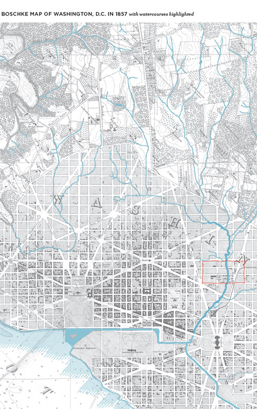
To make the geography a little more understandable for students, I traced the waterways on the 1857 Boschke map of D.C.
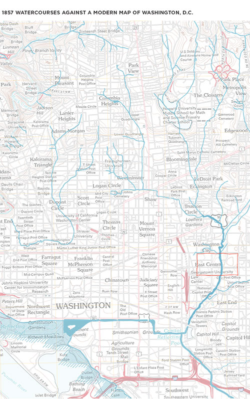
I also overlaid the 1857 waterways onto a modern map.
You can download the maps as high-resolution PDFs:
The tour’s on Saturday 23 May. Full as of Thursday, but I’ll probably re-run it in September.